Categorical Rasters
Rasters can contain either continuous (e.g., elevation) or categorical (e.g., habitat type) data—they are only fancy matrices after all. Here is an example of how to set up a categorical raster with a Raster Attribute Table.
Example Data
These data are from github.
## class : RasterLayer
## dimensions : 246, 138, 33948 (nrow, ncol, ncell)
## resolution : 4, 4 (x, y)
## extent : 304050, 304602, 4133356, 4134340 (xmin, xmax, ymin, ymax)
## crs : NA
## source : /Users/rodney/Desktop/DLab-Spatial/data/pines.asc
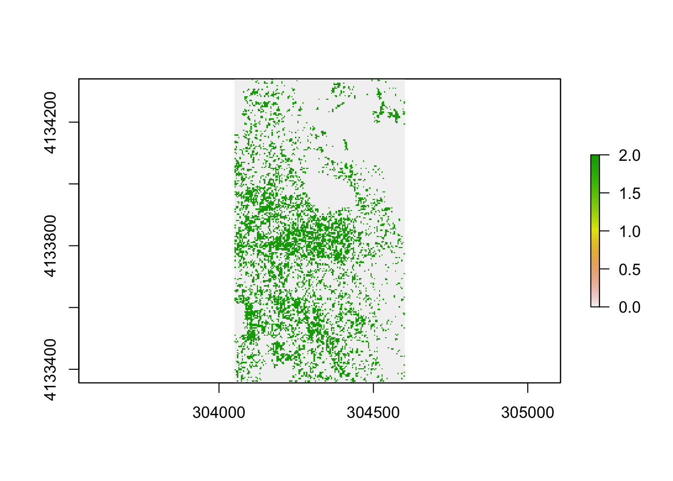
## names : pinesThis is a simple raster with two representations
## [1] 0 0 0 0 0 0 0 0 0 0 0 0 0 0 2 0 0 0 0 0zeros everywhere there is no pines and the category 2 where the conifer canopy exists.
For completeness, I’ll add a few more rasters.
Defining Categories
To begin, lets put these three together1.
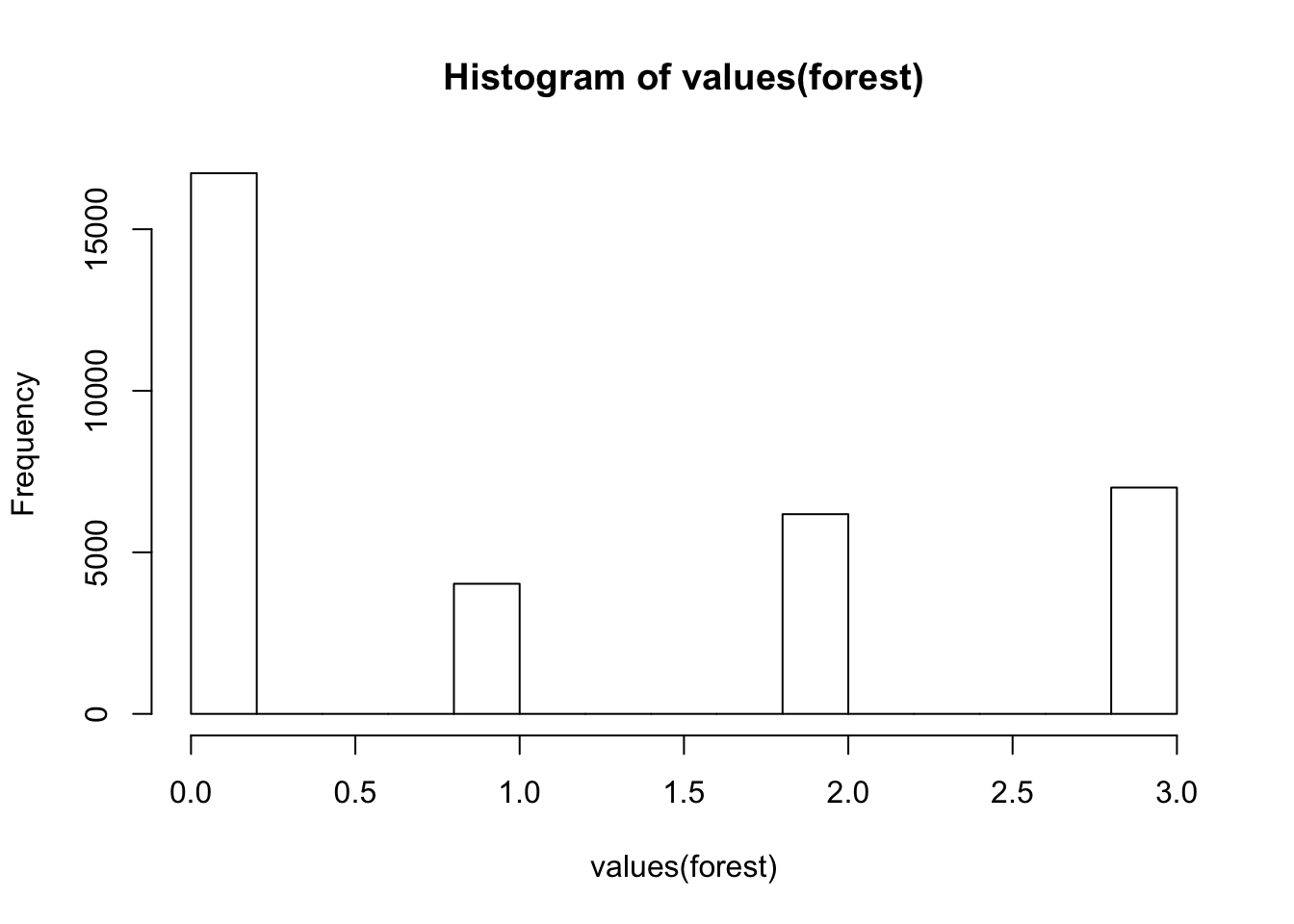
Here is what the actual data look like.
##  [1] 0 0 0 0 0 0 0 0 0 0 0 0 3 1 2 0 0 0 0 0 0 0 0 3 3 3 0 1 3 0 2 0 1 1 1
## [36] 1 1 0 3 3
And it is not a factor:
## [1] FALSETo categorize it, we need to both make it a factor:
##   ID
## 1  0
## 2  1
## 3  2
## 4  3
To make it more usable, we can define these categories on the raster using a Raster Attribute Table (RAT)
forest <- ratify( forest )
rat <- levels( forest )[[1]]
rat$Landcover <- c("Open","Shrubry", "Pines","Oaks")
levels( forest ) <- rat
forest
## class : RasterLayer
## dimensions : 246, 138, 33948 (nrow, ncol, ncell)
## resolution : 4, 4 (x, y)
## extent : 304050, 304602, 4133356, 4134340 (xmin, xmax, ymin, ymax)
## crs : NA
## source : memory
## names : shrubs
## values : 0, 3 (min, max)
## attributes :
## ID Landcover
## 0 Open
## 1 Shrubry
## 2 Pines
## 3 OaksExtracting Data
Now we can play around with the levels a bit. Here, lets summarize a locale by grabbing a point in the middle of the forest raster2.
## [1] "POINT (304402 4133856)"then extract the
##
##  Oaks  Open Pines
##     4     2     6
OK, so now, you have a categorical data raster and can play with it.