sf Objects
We can keep geospatial data in numerical format in normal R structures quite easily. However, there are some reasons we may want to adopt a slightly more sophisticated approach to dealing with our geospatial data. There are several R packages out there for this and the one covered and used here is the sf (Simple Features) package. There are several reasons for this, the most important of which is that it provides a nice interface to work with that integrates with other anlaytical tools.
The Data
Here is some pseudo-hypothetical data to illustrate the basics of the sf objects.
coords <- matrix( c(-122.4787, 48.7519,
                    -90.1994, 38.6270,
                    -93.6319, 42.0308,
                    -77.4527, 37.5483 ),
                  ncol=2, byrow = TRUE)
coords
## [,1] [,2]
## [1,] -122.4787 48.7519
## [2,] -90.1994 38.6270
## [3,] -93.6319 42.0308
## [4,] -77.4527 37.5483sf Objects
There are three basic types of objects: simple feature geometries (sfg), simple features as columns (sfc), and plain simple features (sf). Here is how we get to these.
Points
Starting off with a point, we can define a 2-dimensional coordinate as (by default it is X then Y, so Longitude then Latitude):
## [1] "XY" "POINT" "sfg"Which is simultaneously a POINT object, with XY coordinates, and a Simple Feature Geometry object. Point objects may also have a third coordinate (elevation) or a fourth (often used as precision).
## [1] "XYZ" "POINT" "sfg"Lines
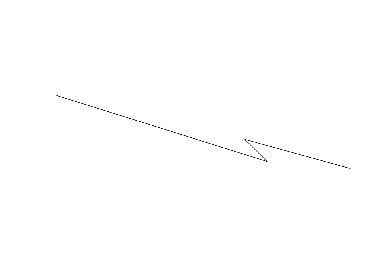
Lines are a collection of coordinates. Here are the same points as before turned into a LINESTRING object.
## [1] "LINESTRING (-122.4787 48.7519, -90.1994 38.627, -93.6319 42.0308, -77.4527 37.5483)"which looks like this.
Polygons
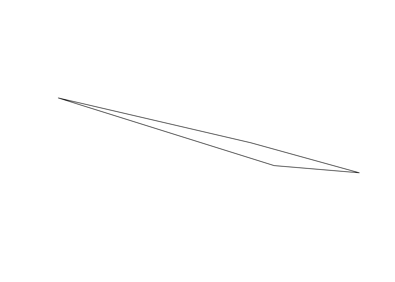
A polygon is a line sequence whose first and last coordinate are the same. We can specify them as a series of points (as above) or derive it from existing structrues. Here is an example where we grab the convex hull (essentially the polygon that encloses all the points as if there was a rubber band stretched around them), using the st_convex_hull function on the LINESTRING object.
## [1] "XY" "POLYGON" "sfg"And can be turned into a polygon as:
Collection of sf Objects.
We can put a bunch of sfg objects into a list and make a collection.
pt_stl <- st_point( coords[2,] )
pt_ame <- st_point( coords[3,] )
pt_rva <- st_point( coords[4,] )
pts <- list(pt_bel, pt_stl, pt_ame, pt_rva)
class(pts)
## [1] "list"To make this a collection of sf objects we:
## [1] "sfc_POINT" "sfc"## Geometry set for 4 features
## geometry type: POINT
## dimension: XY
## bbox: xmin: -122.4787 ymin: 37.5483 xmax: -77.4527 ymax: 48.7519
## epsg (SRID): NA
## proj4string: NAHowever, for completeness, this is really a collection of several points, and is probably more realistically appropriate to be turned into a MULTIPOINT object. For all objects in sf, there are MULTI versions of them for when you have multiple copies. To perform this coversion, we cast the object into a new type (also called coercing the object in the same way you can coerce an integer into a boolean in R). Here is an easy way to do it.
## Geometry set for 4 features
## geometry type:  MULTIPOINT
## dimension:      XY
## bbox:           xmin: -122.4787 ymin: 37.5483 xmax: -77.4527 ymax: 48.7519
## epsg (SRID):    NA
## proj4string:    NA
There are specific rules associated with casting, for example the following fails
## Warning in st_cast.MULTIPOINT(., "POINT"): point from first coordinate only## POINT (1 2)Each of the base types has an eqivallent MULTI version.
Other GEOMETRIES
In addition to these, there are many other geometries available. Most of these are combinations of the point, line, & polygon but are useful in specific situations. These include CIRCULARSTRING, COMPOUNDCURVE, CURVEPOLYGON, CURVE, MULTICURVE, SURFACE, MULTISURFACE, POLYHEDRALSURFACE, TIN, and TRIANGLE. For more information on these, see the PostGIS manual.
Methods on Objects
There are several built-in methods assocaited with sf objects, just as there are for other things in R. When you say plot(x), the kind of thing that x is will determine what function is called. While an sf object is a fancy data.frame with extra propeties, here are a list of recognized methods that you can use with these objects.
##  [1] [                     [[<-                  $<-
##  [4] aggregate             anti_join             arrange
##  [7] as.data.frame         cbind                 coerce
## [10] dbDataType            dbWriteTable          distinct
## [13] extent                extract               filter
## [16] full_join             gather                group_by
## [19] group_map             group_split           identify
## [22] initialize            inner_join            left_join
## [25] mask                  merge                 mutate
## [28] nest                  plot                  print
## [31] raster                rasterize             rbind
## [34] rename                right_join            sample_frac
## [37] sample_n              select                semi_join
## [40] separate_rows         separate              show
## [43] slice                 slotsFromS3           spread
## [46] st_agr                st_agr<-              st_area
## [49] st_as_sf              st_bbox               st_boundary
## [52] st_buffer             st_cast               st_centroid
## [55] st_collection_extract st_convex_hull        st_coordinates
## [58] st_crop               st_crs                st_crs<-
## [61] st_difference         st_geometry           st_geometry<-
## [64] st_interpolate_aw     st_intersection       st_intersects
## [67] st_is                 st_join               st_line_merge
## [70] st_nearest_points     st_node               st_normalize
## [73] st_point_on_surface   st_polygonize         st_precision
## [76] st_segmentize         st_set_precision      st_simplify
## [79] st_snap               st_sym_difference     st_transform
## [82] st_triangulate        st_union              st_voronoi
## [85] st_wrap_dateline      st_write              st_zm
## [88] summarise             transmute             ungroup
## [91] unite                 unnest
## see '?methods' for accessing help and source code
As you see, you can use the square braket and dollar sign notation just for data.frames. You should also notice several of the functions associated with dplyr (e.g., distinct, filter, mutate, merge, sample, summarize, etc.). Then there is all those st_ functions at the bottom. These are what we call generic functions that operate on these objects and are what we use for geospatial analyses.
Look at the generics for sfc
##  [1] [                     [<-                   as.data.frame
##  [4] c                     coerce                format
##  [7] fortify               identify              initialize
## [10] obj_sum               Ops                   print
## [13] rep                   scale_type            show
## [16] slotsFromS3           st_area               st_as_binary
## [19] st_as_grob            st_as_sf              st_as_text
## [22] st_bbox               st_boundary           st_buffer
## [25] st_cast               st_centroid           st_collection_extract
## [28] st_convex_hull        st_coordinates        st_crop
## [31] st_crs                st_crs<-              st_difference
## [34] st_geometry           st_intersection       st_intersects
## [37] st_is                 st_line_merge         st_nearest_points
## [40] st_node               st_normalize          st_point_on_surface
## [43] st_polygonize         st_precision          st_segmentize
## [46] st_set_precision      st_simplify           st_snap
## [49] st_sym_difference     st_transform          st_triangulate
## [52] st_union              st_voronoi            st_wrap_dateline
## [55] st_write              st_zm                 str
## [58] summary               type_sum
## see '?methods' for accessing help and source code
and sfg
##  [1] as.matrix             c                     coerce
##  [4] format                fortify               head
##  [7] initialize            Ops                   plot
## [10] print                 show                  slotsFromS3
## [13] st_area               st_as_binary          st_as_text
## [16] st_boundary           st_buffer             st_centroid
## [19] st_collection_extract st_convex_hull        st_coordinates
## [22] st_difference         st_geometry           st_intersection
## [25] st_intersects         st_is                 st_line_merge
## [28] st_nearest_points     st_node               st_normalize
## [31] st_point_on_surface   st_polygonize         st_segmentize
## [34] st_simplify           st_snap               st_sym_difference
## [37] st_transform          st_triangulate        st_union
## [40] st_voronoi            st_wrap_dateline      st_zm
## see '?methods' for accessing help and source code